Give TODAY with 3X Match AND enter to win the Ultimate Stowe Ski Getaway
Donate to Win
Donate to Win
When Daniel and his mom first set eyes on the farm, it seemed like paradise: a quiet little valley, clear water running down from the forested hills, rich soils, and one of the most historic barns around – everything one would hope for in a family farm. Along with his mom and growing family, Daniel put in the sweat equity to restore the 1820s farmhouse, till the land, and bring the farm back to life.
But too often over these nearly 30 years, Daniel looked across the land only to be greeted by too much water: of the 17 floods he endured, 5 filled the basement. In just the last two years, 2 floods filled the house with standing water, destroying everything – the welder, furniture, memories. Now their beloved home is mold-infested and no longer safe. Nearby, willows took root and beavers moved in, quickly creating a series of stepped dams, bringing the river’s natural wetlands back to life.

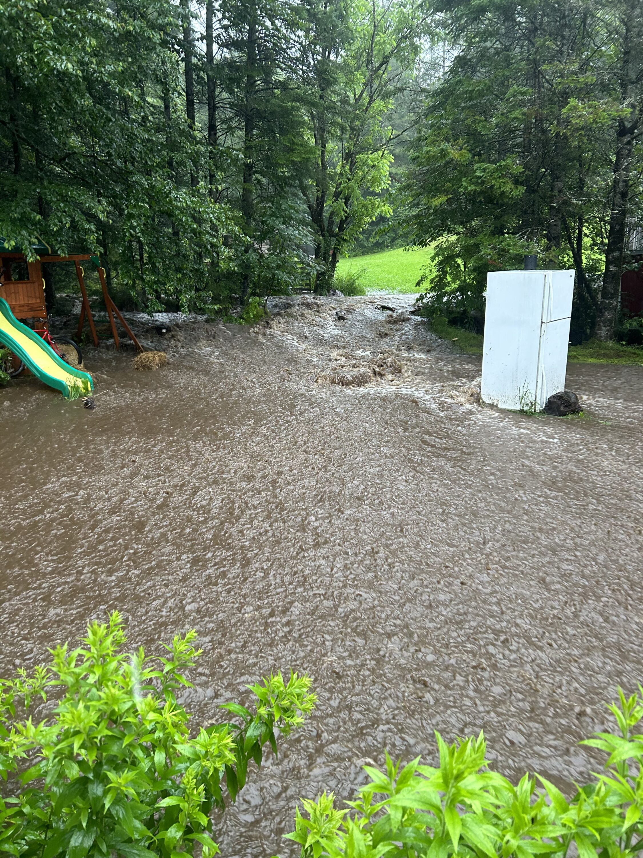
Flooding over the road and farm.
After too many floods and too much grief, Dan decided the land would make a better floodplain than a farm, and luckily, Worcester’s selectboard agrees. Just one challenge: A small town with only a few part-time staff already navigating several FEMA projects, Worcester wasn’t sure they could help Daniel through the buyout paperwork. This is where our staff stepped in to help Daniel and the town navigate these complexities. Yes, the town might lose a little tax revenue via a buyout, but they’d gain something far more valuable: a floodplain where the river can overflow, spill across the land, slow, and store water during floods.

The North Branch of the Winooski flooding across Daniel’s front yard.
Letting this land be open space means Highway 12 is less likely to wash out, helping keep the major roadway open during emergencies. It means homes downstream are less likely to flood, keeping the community safer. These intangibles – the increased safety of not flooding – are big savings for a small town, and we’re glad we could play a role in helping Daniel’s family and the Town of Worcester find a path forward together.

Channel erosion after a flood through the yard.
Not too far away, Barre is navigating more than 20 buyouts like this – places where homes have flooded again and again, and residents are ready to move to higher ground. We’re stepping up to help the city think about what to do with this newly open space, in part with an eye to recreation as part of a Friends of the Winooski River-led river recreation master plan. Knowing it’s too easy for city staff already stretched thin to simply plant grass seed, we’re helping the city figure out the best ways to make these lands even more flood resilient – from planting riverfront trees and shrubs, to removing artificial banks, to restoring wetlands. Ultimately, we’re helping the city envision a string of riverfront parkland that protects homes from the next big flood and gives people places to enjoy cool, clear waters.
Farther northeast, where Millers Run meanders through Sheffield farmland en route to the Connecticut River, we’ve made sure the riverbanks will always be surrounded by trees and shrubs, and the river can always flood across the land. Conserving these natural floodplains makes everyday life better for people nearby, particularly for friends and neighbors who are older, don’t have a car to flee floods or get to services, or don’t have internet at home, all factors that make flood recovery even more challenging.
These kinds of places – homes, farms, cities, and towns that flood and flood again – are too costly to bail out time and time again, and there’s far more community value to the land when it can restored back to the floodplain it once was – places where rivers can spill over their banks, slow across the land, store water during floods, and keep our communities safer.
These are just a handful of the stories behind our conservation work, where people and science – climate change and vulnerable communities – are intertwined at the rivers’ edge.

Daniel is seeing more and more moose as the river’s natural wetlands come back to life.
Subscribe and get the latest on VRC’s initiatives and events.